This search will return exact matches only. For best results:
Please note that only low-res files should be uploaded. Any images with overlay of text may not produce accurate results. Details of larger images will search for their corresponding detail.
Drag file here
Upload
Processing search results
Waiting for update..
Error:
Search by Colour
Advanced Search
Search Tips
Searching for a particular field
Field
Search term
Example
Asset title
title:
title:pony
Asset title and keywords
~
~pony
Asset description text
description:
description:london
Agency prefix
prfx: or $
prfx:lal or $LAL
Asset id
imageid:
imageid:250297 or imageid:[2500 TO 4000]
Agency name
coll:
coll:history
Medium
medium:
medium:oil
Century
century:
century:20th
Keywords
kw:
kw:dog
Artist name
artist: or ?
artist:monet or ?monet
Artist nationality
??
??French
Creator ID
creatorid:
creatorid:37
Location
loc: or @
loc:exeter or @exeter
Classification
class: or #
class:57 or #57. Use # for unclassified assets
Year
year:
year:1850 or year:[1700 TO 1800]
Metadata Block (Hidden)
Contact us for further help
High res file dimension
Search for more high res images or videos
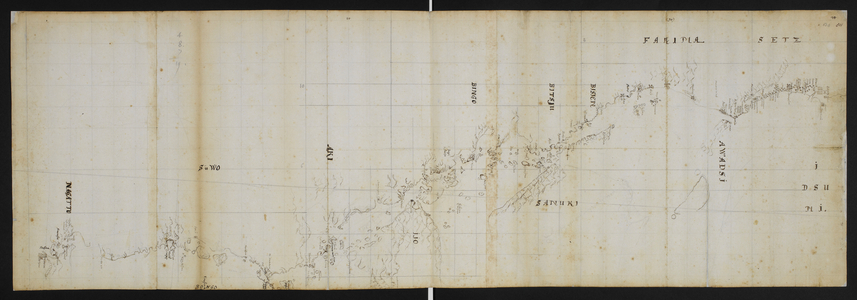
Chart with notes by Captain James Cook, c.1760-1780 (drawing)
IMAGE
number
BL5623879
Image title
Chart with notes by Captain James Cook, c.1760-1780 (drawing)
Sixty-seven Charts and maps illustrating the voyages and surveys of Capt. James Cook, R.N, and other discoverers; circ. 1760- 1780. By Cook, Captain James. Chart with notes, c 1760-1780
Photo credit
From the British Library archive / Bridgeman Images
 by Cook, James (1728-79)")